
CIRCUS ANTARCTICA, Part 3
What does the Polar Expeditions Classification Scheme (PECS) bring?
Title-Photo Christoph Höbenreich hauls his sled and combined polar/mountain ski equipment on a loop through the Drygalski, Holtedahl and Conrad Mountains in East Antarctica. Photo: Paul Koller 2009
In order to allow fair comparisons between polar journeys and to better represent the myriad users of our high latitudes, an international team led by the Australian initiator Eric Philips with Steve Jones (UK), Damien Gildea (Australia), Michael Charavin (France) and Christoph Höbenreich (Austria) worked for over a year to develop a clear and comprehensive system of definitions and guidelines.
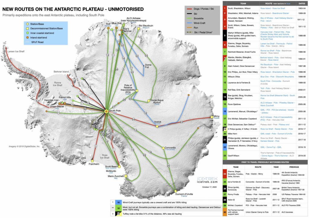
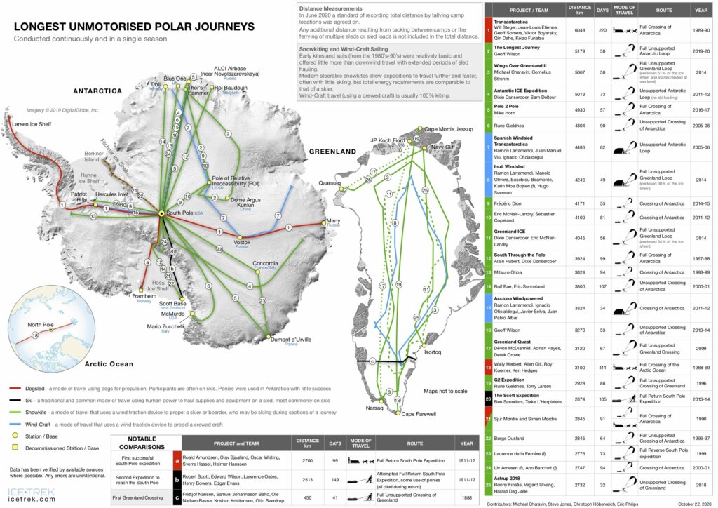
The extensive Polar Expeditions Classification Scheme (PECS) characterises contemporary polar travel by combining traditional and modern terminology into a simple label that tells the story of the journey. It includes a value-free classification system with definitions for commonly used terms including travel disciplines, geographic regions, route geometry and types of aid. PECS applies to extended, non-motorised polar trips, primarily on land or sea ice (though extends to water activities) whose route can take the form of crossings, expedition variants, circumnavigations or loops. PECS principally covers Antarctica, Greenland and the Arctic Ocean however it can also be used for ice travel in non-polar regions such as Patagonia, Lake Baikal, Alaska etc. Relevant geographic features, modes of travel, start and end points (Margins), routes and directions (Paths) and various types of support (Aid) are systematically defined and provide polar travellers help with classifying their trip and comparing it to others. Together with the clear description of the discipline (ski, snowkite, bicycle etc.), it’s possible to differentiate between sports and objectively compare the nuance of each journey. For example, a trip that is carried out over multiple seasons (discontinuous) cannot claim the sum of its achievement, only the individual sectors, so a team that skis from the coast of Antarctica to the South Pole in one year and then South Pole to an opposite coast the following year, may not claim the two expeditions as a crossing of Antarctica. In this way, PECS creates a framework that takes historical performance into account and allows a more objective assessment of new performances. Guinness World Records now uses PECS to accurately assess polar claims.
PECS has yet to prove itself in the marketplace, to show that the full colour of polar dreams and achievements can fit into its palette, but this first step in the classification of polar travel is an important one. Or as one critical mind put it: ‚It is complicated. But it is the most compact simplification of the complication ‚.
PECS SUMMARY
Number of participants (team size)
Team
More than one person during all or part of a trip
Solo
A single person travels alone for the entire length and duration of a trip. If solo is not explicitly mentioned, a team is assumed. Soloists should only have temporary encounters with other people.
Mode of travel
Travel mode is the discipline used to move the adventurer and his/her equipment, usually a sled (pulka), across the snow, ice or water. ‘Ski’ is the most traditional and common discipline but other foot methods are recognised eg. snowshoes, running etc. The antiquated terms of ‚unassisted‘ or ‚unmotorised‘, used to emphasise that no energy created by wind, dogs or mechanisation were used for propulsion, are no longer necessary as the various modes of locomotion are simple, clear and self-explanatory. Combinations are also possible.

Ski
Using skis for the majority of a journey

Foot
Using footwear or any footwear attachment for walking or running
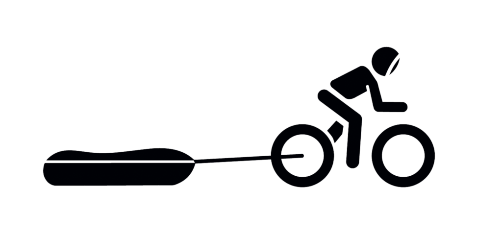
Pedal drive
Using a pedal drive to propel a craft
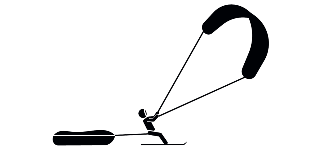
Snowkite (Snowkiting, Kiteskiing, Skisailing)
Using a wind traction device to propel a skier or boarder

Wind-Craft (Snowsailing)
Using a wind traction device to propel a crewed craft over ice/snow.

Dogsled
Using dogs for propulsion
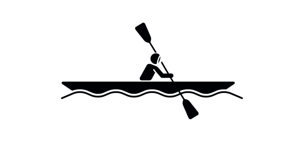
Paddle
Using a watercraft propelled by paddling
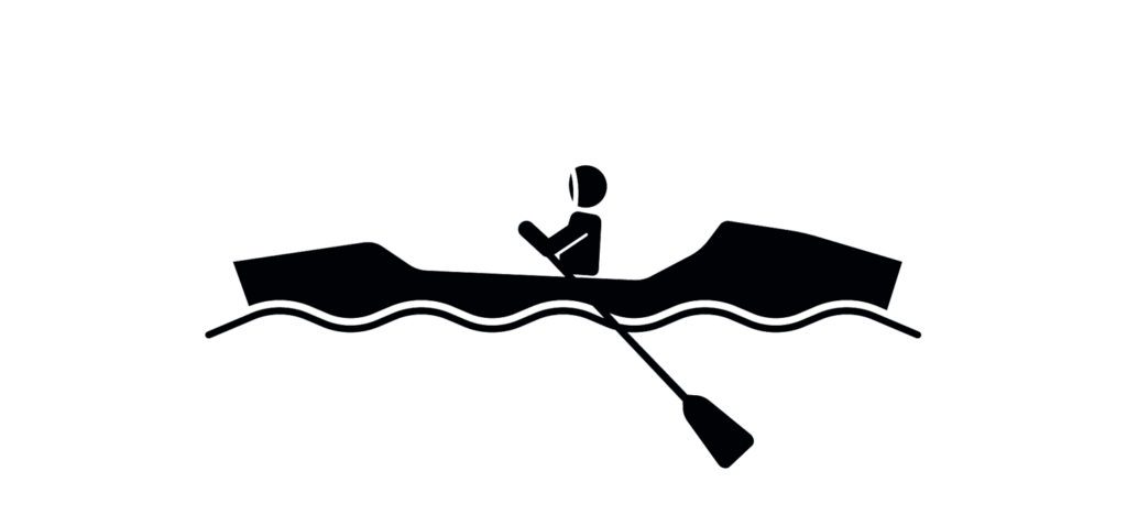
Row
Using a watercraft propelled by oar-locked rowing
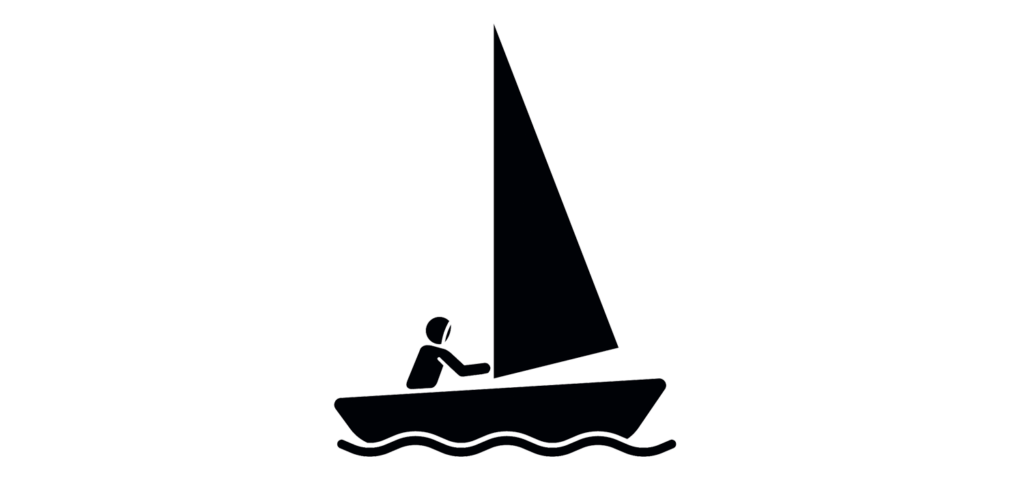
Sail
Using a watercraft propelled by wind
(Pictograms by Philips, Höbenreich, max2.at, © PECS)
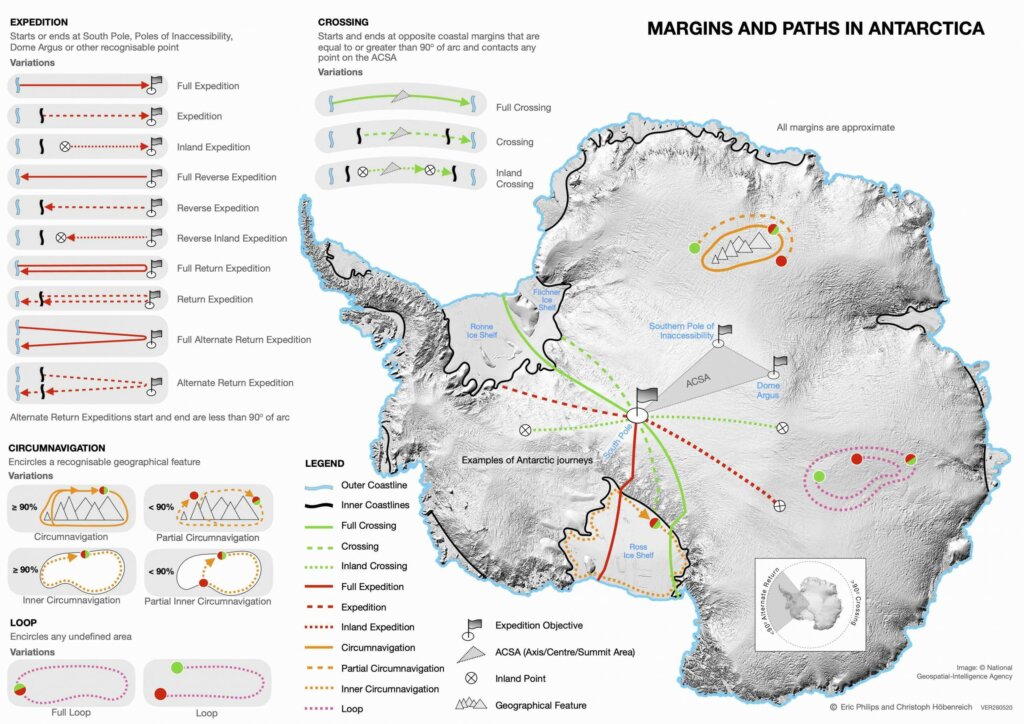
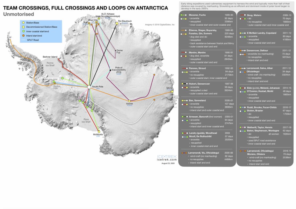
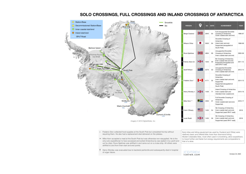
Margins of Antarctica, Start and End points (Fig. 22)
The start and end point of a trip are determined by geography and usually have a historical context.
Outer/Seaward Coastline
A coastline fronted by sea or annual sea ice, including the outer coastline of ice shelfs (typically used on early expeditions, now rarely used)
Inner/Landward Coastline
The landward edge of an Antarctic ice shelf, where the land ice begins to float.
Inland Point
A point inland of an inner coastline
Full
A journey that uses an outer coastline(s) is considered as Full. A Full South Pole expedition begins on an outer coastline. A full crossing of Antarctica begins and ends on opposite outer coastlines.
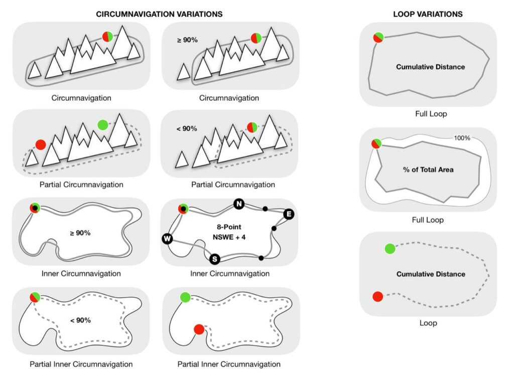
Paths (Fig. 22 und 23)
A Path characterises the direction and route of a trip from start to end and includes a definable geographical feature as an objective.
Geographical Feature
A geographical feature is a recognisable feature that can be reached, circumnavigated, crossed or climbed as a defined destination of a polar trip, e.g. ice cap, mountain, island, lake, archipelago, continent etc.
Crossing
A crossing traverses a geographical feature (for example the continent of Antarctica), begins and ends at opposite points or edges and has an arc of at least 90° between start and end.
Double Crossing
A Path that crosses and returns to the original start point. Often made in Greenland.
Expedition
A traditional term commonly used for a journey that is exploratory, or that leads to remote or undeveloped areas. For modern polar travel, it is also a general term for a path that is neither a crossing, circumnavigation or loop.
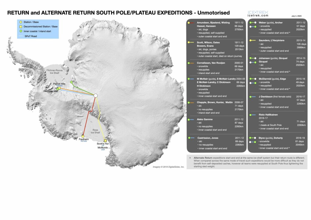
Return Expedition
A Path that starts and ends at the same point or along the same line, reaching a significant feature at its furthermost point.
Alternate Return Expedition
Travels out and back on a different route that is less than 90º of arc between start and end
Reverse Expedition
Starts at a significant feature, usually mid-ocean or mid-continent, and ends at a coastline eg. North Pole to Canada.
Circumnavigation
A Path that encircles of a recognisable geographical feature (e.g. a mountain range), covering at least 90% of its extent and starting and ending at the same point
Partial Circumnavigation
A Path that encircles a definable geographical feature and is less than 90% of its size or does not start and finish at the same point.
Inner Circumnavigation
A Path that encircles a definable geographical feature (for example a frozen lake) along its inner circumference, covers more than 90% of the extent of the feature and has start and finish at the same point.
Partial Inner Circumnavigation
A Path that encircles a definable geographic feature along its inner circumference and is less than 90% of its extent of the feature, or the start and finish are not at the same point.
Full Loop
A path that circles an undefined area and starts and ends at the same point. Usually only completed by snowkiters or wind-craft sailors.
Loop
A curved Path that partially encircles an undefined area or whose start and end lie at different points.
Continous Journey
An unbroken journey that has not been fragmented into multiple legs, expeditions or detached season
Discontinous Journey
A journey broken across multiple legs, expeditions or detached seasons. Not continuous.
Distances
The standardised method of recording total distance is the tallying of camp location intervals, including start and end points. In addition journeys can record finer waypoint intervals eg. 30 minutes, however the camp to camp tally will be the accepted distance. Journeys on the Arctic Ocean also record a camp to camp tally that takes into consideration overnight drift.
Support/Aid
A polar trip is considered Unsupported if:
- it does not receive any external resupply of food, fuel or equipment, either pre-placed or delivered during the journey. Caches laid by the expeditioner or team during the course of the journey are not considered Support.
- it does not use an aircraft or motorized vehicle that provides physical and/or psychological support
- no team members are evacuated.
- it does not enter buildings, aircraft or vehicles, or tents other than their own, during the course of the journey
- it does not use any type of road, vehicle track or marked route except when following routes into, out of or around bases, stations and camps as directed by authorities. Use of the Leverett Glacier is classified as Support.
- it does not off-load anything but human waste and greywater. Human waste and greywater collected south of 89° in Antarctica may be disposed of at South Pole as advised by authorities.
A trip is considered supported if it receives one or more of the above points. The use of GPS or route data for navigation, satellite comms, weather and ice forecasts, or external advisors on standby are now commonplace and not considered forms of support (in some areas expeditions cannot proceed without daily reports) however completing a journey with minimal reliance on these aids is a display of physical and psychological self-sufficiency. Professionally guided journeys are also not classified as supported as the guide is not being guided, however this fact should not be left undisclosed when promoting or blogging about the trip. And if a pre-journey trip description no longer applies post journey it should then be amended to reflect the actual trip carried out.
Labels
A label is a synthesis of qualifying key words that briefly describes a polar trip, eg: ‚South Pole Ski Last Degree Expedition‘, ‚Solo Full Ski Crossing of Antarctica‘, ‚Alternate Return South Pole Snowkite Expedition‘, ‚Inland Wind-Craft Crossing‘ of Antarctica‘, ‚Reverse South Pole Bicycle Expedition‘, ‚Partial Ski Circumnavigation of Ellsworth Mountains‘, ‚Solo Iceskate Inner Circumnavigation of Lake Baikal‘, ‚Reverse Solo Unsupported South Pole Snowkite Expedition‘, etc.
Verification
PECS terminology and guidelines can be used by anybody. Claims and data must be credible and verified through GPX tracks, waypoint data, detailed route information, pictures, etc.
PECS definitions, guidelines and maps will be available at www.pec-s.com before 2021. The content of this article is accurate to the best of our knowledge however it is not guaranteed to be free from errors.
International Polar Guides Association (IPGA)

Founded in Svalbard in 2010 and based in Canada, the International Polar Guides Association regulates the quality of polar guiding through its guide endorsement process, through the standardisation of skills and practices and the provision of resources to up-skill both prospective and endorsed guides. IPGA provides support to the polar guiding community and its clientele by standardising work practices and regulations that govern the profession, by encouraging the highest possible level of safety and satisfaction for clients and by providing public transparency of guide skills, capabilities and qualifications.
IPGA unites 32 of the most experienced polar guides from Australia, Belgium, France, Great Britain, Iceland, Canada, Norway, Austria, Russia, Switzerland, Spain and the USA. www.polarguides.org


